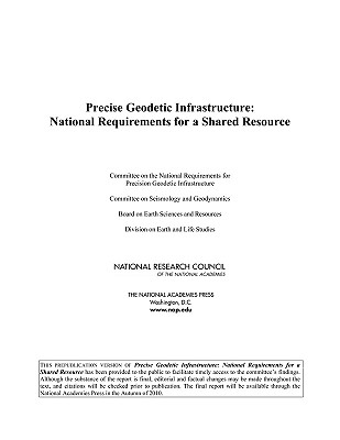
Geodesy is the science of accurately measuring and understanding three fundamental properties of Earth: its geometric shape, its orientation in space, and its gravity field, as well as the changes of these properties with time. Over the past half century, the United States, in cooperation with international partners, has led the development of geodetic techniques and instrumentation. Geodetic observing systems provide a significant benefit to society in a wide array of military, research, civil, and commercial areas, including sea level change monitoring, autonomous navigation, tighter low flying routes for strategic aircraft, precision agriculture, civil surveying, earthquake monitoring, forest structural mapping and biomass estimation, and improved floodplain mapping. Recognizing the growing reliance of a wide range of scientific and societal endeavors on infrastructure for precise geodesy, and recognizing geodetic infrastructure as a shared national resource, this book provides an independent assessment of the benefits provided by geodetic observations and networks, as well as a plan for the future development and support of the infrastructure needed to meet the demand for increasingly greater precision. Precise Geodetic Infrastructure makes a series of focused recommendations for upgrading and improving specific elements of the infrastructure, for enhancing the role of the United States in international geodetic services, for evaluating the requirements for a geodetic workforce for the coming decades, and for providing national coordination and advocacy for the various agencies and organizations that contribute to the geodetic infrastructure.
Geodesy is the science of accurately measuring and understanding three fundamental properties of Earth: its geometric shape, its orientation in space, and its gravity field, as well as the changes of these properties with time. Over the past half century, the United States, in cooperation with international partners, has led the development of geodetic techniques and instrumentation. Geodetic observing systems provide a significant benefit to society in a wide array of military, research, civil, and commercial areas, including sea level change monitoring, autonomous navigation, tighter low flying routes for strategic aircraft, precision agriculture, civil surveying, earthquake monitoring, forest structural mapping and biomass estimation, and improved floodplain mapping.
Recognizing the growing reliance of a wide range of scientific and societal endeavors on infrastructure for precise geodesy, and recognizing geodetic infrastructure as a shared national resource, this book provides an independent assessment of the benefits provided by geodetic observations and networks, as well as a plan for the future development and support of the infrastructure needed to meet the demand for increasingly greater precision. Precise Geodetic Infrastructure makes a series of focused recommendations for upgrading and improving specific elements of the infrastructure, for enhancing the role of the United States in international geodetic services, for evaluating the requirements for a geodetic workforce for the coming decades, and for providing national coordination and advocacy for the various agencies and organizations that contribute to the geodetic infrastructure.
Get Precise Geodetic Infrastructure by at the best price and quality guranteed only at Werezi Africa largest book ecommerce store. The book was published by National Academies Press and it has pages. Enjoy Shopping Best Offers & Deals on books Online from Werezi - Receive at your doorstep - Fast Delivery - Secure mode of Payment
 Jacket, Women
 Woolend Jacket
 Western denim
 Mini Dresss
 Jacket, Women
 Woolend Jacket
 Western denim
 Mini Dresss
 Jacket, Women
 Woolend Jacket
 Western denim
 Mini Dresss
 Jacket, Women
 Woolend Jacket
 Western denim
 Mini Dresss
 Jacket, Women
 Woolend Jacket
 Western denim
 Mini Dresss


