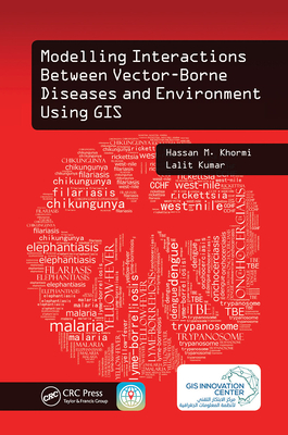
Master GIS Applications on Modelling and Mapping the Risks of Diseases
Infections transmitted by mosquitoes, ticks, triatomine bugs, sandflies, and black flies cause significant rates of death and disease, especially in developing countries. Why are certain places more susceptible to vector-borne diseases? Modelling Interactions Between Vector-Borne Diseases and Environment Using GIS reveals how using geographic information systems (GISs) can provide a greater understanding of how vector-borne diseases are spread and explores the use of geographical techniques in vector-borne disease monitoring, management, and control. This text provides readers with a better understanding of the vector-borne disease problem and its impact on public health.
Introduces New Spatial Approaches Based on Location and Environment
The book exposes readers to information on how to identify vector hotspots, determine when and where they can occur, and eliminate vector breeding sites. Utilizing simple illustrations based on real data, as well as the authors more than 20 years of experience in the field, this text combines key spatial analysis techniques available in modern GIS with real-world applications. It offers step-by-step instruction on developing vector-borne disease risk models at different spatial and temporal scales and helps practitioners formulate disease causation hypotheses and identify areas at risk. In addition, it addresses medical geography, GIS, spatial analysis, and modelling, and covers other factors related to the spread of vector-borne diseases.
This book:
- Gives an overview of common vector-borne diseases, GIS-based mapping and modelling, impacts of climate change on vector distributions, and availability and importance of accurate epidemiologically relevant spatial data
- Describes modelling and simulating the prevalence of vector-borne diseases around the world
- Summarizes some key spatial techniques and how they can be used to aid in the analysis of geographical and attributed data
- Defines the concept of establishing and characterizing spatial data systems, including their quality, errors, references, and issues of scale, and building such a system from often quite separate, disparate sources
- Shows how to develop weather-based predictive modelling, which can be used to predict the weekly trend of vector abundance
- Provides a GIS case study for modelling the future potential distribution of vector-borne disease based on different climatic change scenarios
Modelling Interactions Between Vector-Borne Diseases and Environment Using GIS
combines spatial analysis techniques available in modern GIS, together with real-world applications to provide you with a better understanding of ways to map, model, prevent, and control vector-borne diseases.
 Jacket, Women
 Woolend Jacket
 Western denim
 Mini Dresss
 Jacket, Women
 Woolend Jacket
 Western denim
 Mini Dresss
 Jacket, Women
 Woolend Jacket
 Western denim
 Mini Dresss
 Jacket, Women
 Woolend Jacket
 Western denim
 Mini Dresss
 Jacket, Women
 Woolend Jacket
 Western denim
 Mini Dresss


